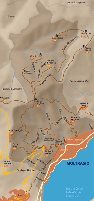
Basic municipal data and maps of Moltrasio:
• altitude between 200 and 1250 metres above sea level;
• main exposition: south-east on the slope facing the lake, and north-west in the upper part of the territory
• surface area: 8.86 square km. (2190 acres).
The town is set on a limestone substratum, very rich in silica, known as “Moltrasio stone or rock”, and extends from Bisbino to the shores of the lake, and from Val d’Intelvi to Mount Generoso.
The local terrain is derived from this rock, with a neutral-acid tendency, also because of the natural accumulation of plant matter, which, over time, becomes an organic component of the soil, increasing the acid content.
This kind of terrain is favourable for a wide range of plant, herbage, shrub and tree species, according to the geological matrix or ground-mass, but also depending on the relative depth, as well as the environmental temperature and humidity
All these aspects contribute to the great biodiversity found in these areas, resulting in natural vegetation composed of over 700 different classified species.
WEBCAM
Webcam inactive